Landesarchiv Baden Württemberg
ArcGIS, QGIS or web apps can simply use this map with web map services. WMTS, TileJSON or XYZ tiles are provided for quick access to processed maps.
Sign in to get links.
Sign in to download GeoTIFF.
Overlay & compare
iiif viewer, iiif info json
Website
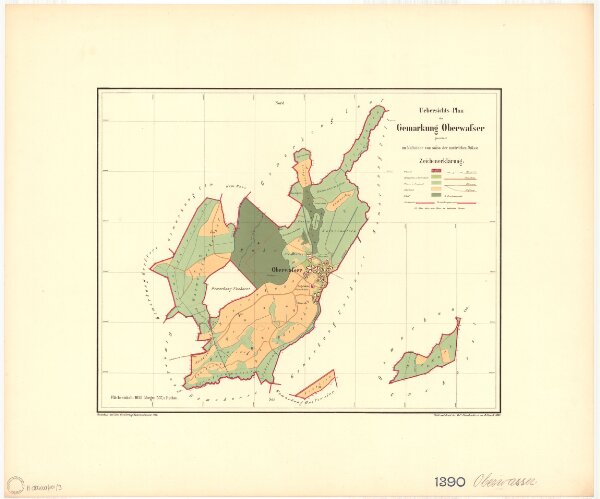
Oberwasser, Unzhurst, Ottersweier, RA mit Unzhurst. GLAK H-1 Gemarkungspläne
H-1_1390
From 1866 to 1867